Tearing your hair out in traffic and ready to try something different? PVD Streets is here for you!
There are so many reasons why we need more choices for getting around Rhode Island. The Washington Bridge fiasco has shown us that our transportation system is far too fragile – in addition to stronger supports for bridges, we also need stronger choices for getting around so the whole system doesn’t collapse when one piece breaks. A real economy thrives on transportation choices – and that means driving, trains, buses, bikes, ferries, scooters, wheelchairs, strollers and of course – our own two feet.
We know that many people will always have to drive to get around. But for those who might be able to try a different way, this guide is for you.
Inside, you will find:
- Sign-up form for support for biking or busing over the Seekonk
- Videos on how to ride RIPTA, how to put your bike on a RIPTA bus, and the routes that serve the East Bay
- A map of parking lots along the East Bay Bike Path so you can drive partway and ride the rest
- How to navigate safely and find the best biking/scooting/rolling routes
Do you need individualized support – a bike buddy? A child seat for your bike? A customized route? Email us at info@ourstreetspvd.org and we will do our best to help you.
***
1. Sign up to give or receive support
Is your driving commute being affected by the Washington Bridge closure? Are you ready to try taking the bus or riding a bike to get yourself out of the traffic nightmare? The Providence Streets Coalition is here for you! Tell us what you need, or what you can offer, and we will try to make your trips across the Seekonk River less stressful.
SIGN UP HERE
***
2. Riding RIPTA
RIPTA has the following helpful resources for first-time bus riders:
- RIPTA How to Ride Guide
- RIPTA ADA Paratransit User Guide
- Video: Pointers for Riding RIPTA
- Video: How to put your bike on the bus (this is from Colorado but RIPTA uses these exact same bike racks)
The bus routes that go over the Washington Bridge are:
The bus routes that go over the Henderson Bridge are:
***
3. Parking along the East Bay Bike Path
Maybe it makes sense for you to drive partway and ride or walk the rest! That’s great. Here’s a list of lots along or near the path, going as far south as Kettle Point:
- India Point Parking Lot
- John H. Lewis Waterfront Park
- EBBP Lot #1 on Veteran’s Memorial Parkway
- EBBP Lot #2 on Veteran’s Memorial Parkway
- EBBP Lot #3 on on Kettle Point
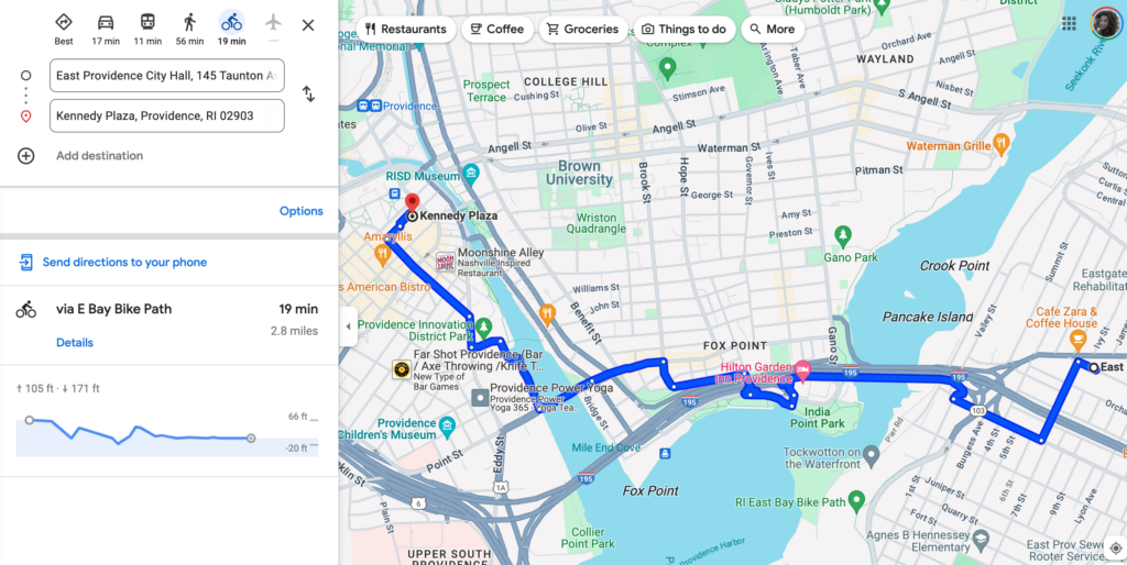
4. Bike/Scooter Navigation and finding the best routes:
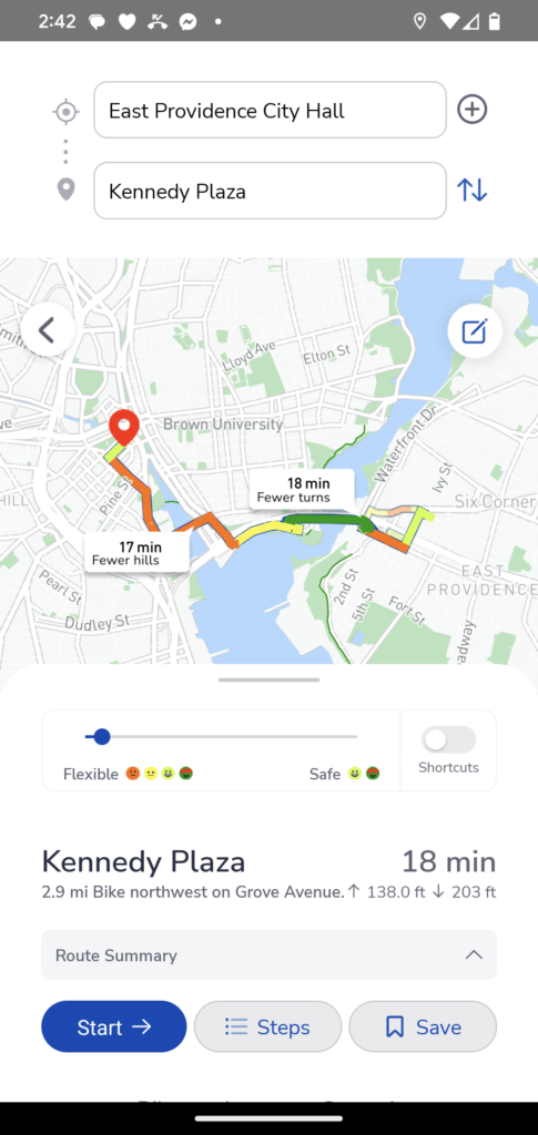
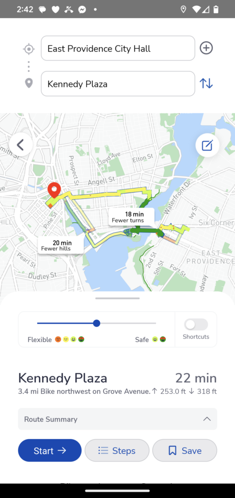
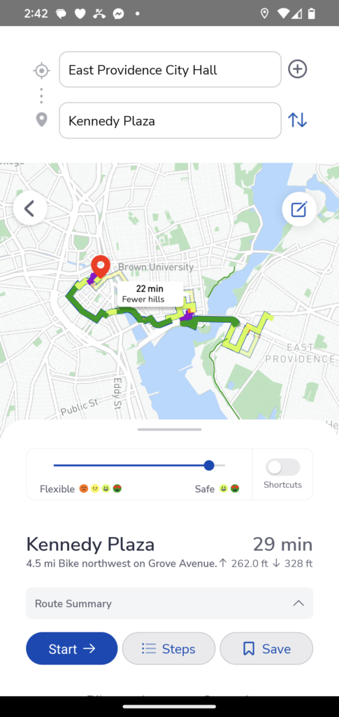
When you’re going to/from the East Bay path or between other destinations, we strongly recommend using the Pointz navigation app to find the best route for you to your destination. Google bike directions works well too, but it will only gives you the fastest option, Pointz allows you to customize your route and choose the safest (best bike infrastructure, lowest speed roads) or the fastest/most direct, or a balance of both.
For the safest navigation experience where you’re relying on turn-by-turn directions, do one of the following:
- Buy a phone mount for your bike (see gear guide below)
- Listen to the turn-by-turn directions with ONE earbud
- Listen to the turn-by-turn directions via a small bluetooth speaker attached to your bike or backpack
Example: Google Bike Directions
Example: Pointz Directions, fastest option, balanced option, safest option: