Additional Reading
To learn more about additional efforts in improving street lighting on North Main Street, please check out our Street Lighting page.
North Main Street: Pedestrian Safety Intervention Needed After Tragic Deaths
North Main Street needs rapid intervention before someone else’s life is seriously altered or ended. As preventable deaths and injuries on North Main Street continue to occur with regularity, reimagining this corridor is long overdue.
Love and Remembrance on North Main Street:
A Vigil and Rally for Pedestrian Safety
Join us on (Date TBD) at the corner of North Main Street and Doyle Ave in Providence for Love and Remembrance on North Main Street: A Vigil and Rally for Pedestrian Safety.
Note: The image below for the event on Feb 14, 2023 was postponed due to inclement weather. A new date will be announced in the future.
With three fatalities in 2023, Zacory Richardson (38), Vanda Makovetskiy (85), and Edwin English (57), we cannot wait any longer for action on North Main Street. We hope you will join us to honor the victims of traffic violence and join together to prevent another tragedy from happening on this or any other street in PVD.
Providence Streets Coalition’s recommendations for the North Main Street Task Force:
Short Term:
- Immediately repair any street lights currently not functioning.
- Implement an ongoing monitoring process to ensure that malfunctioning lights are handled swiftly.
- Initiate a review process examining the effectiveness of street light coverage over crosswalks, ensuring that all crosswalks are completely lit.
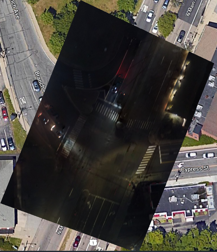
- (See Branch Ave intersection as an example needing improvement.) This will likely require adding additional lights and replacing existing lights with brighter units that cast a broader pool of light to cover the street’s expansive width. Consult any relevant standards or guidelines for light intensity over crosswalks.
- On-street review of all pedestrian signals to ensure they are currently functioning.
- In recent months, at least two malfunctioning signals were reported to PVD311 and RIDOT. Implement an ongoing monitoring process to ensure that malfunctioning signals are identified and repaired quickly.
- Exclusive pedestrian phasing paired with no-turn-on-red signage at all NMS-signaled intersections.
- Some intersections (ex. Branch) do not currently have pedestrian crossings in all directions. Exclusive phasing will allow for added crosswalks, which should be painted.
- The pedestrian phase should be pushbutton-actuated to prevent unnecessary vehicle traffic backups, with priority given to the pedestrian phase at the next change of signal after actuation to reduce pedestrian wait time.
- Pedestrian phase duration should accommodate diagonal crossing.
- Initiate a process to develop a Restriping Plan, with review and approval by the NMS Task Force and GCSC, to include:
- Narrower travel lanes, possibly enabled by shifting of parking zone slightly away from the curb.
- Tightening turn radii at all intersections (signaled and otherwise), possibly with temporary physical barriers for daylighting, for the entire length of N. Main Street from Pawtucket to Canal Street.
- Add temporary physical barriers (i.e. jersey barriers) where appropriate (ex. Rochambeau northbound) to prevent shoulders from being used as slip lanes. This is a big problem due to NMS’s ample shoulder space and sparse parking at some intersections.
- Add mid-block crosswalks with temporary speed humps on all lanes, with physical barriers in the shoulder to daylight, and reduce crossing distance, at intervals that comply with current standards.
- The stretches north and south of Rochambeau are long and largely uninterrupted, and traffic moves fast. In a 0.7-mile stretch, Rochambeau offers the only pedestrian crossing. Expecting pedestrians to go 5-10 minutes out of their way to cross is not a reasonable expectation
- (For example: businesses north of Branch rely heavily on parking in the southbound lane, which requires crossing.)
- Add temporary speed humps at locations with the five highest rates of pedestrian crashes.
- Speed humps should span shoulders as well as travel lanes to prevent the use of the shoulder as a bypass/slip lane. According to the City’s High Injury Network and PSC’s PVD Crash Data portal, the locations that should be prioritized are:
- N Main St @ Doyle Ave
- N Main St @ Randall St/Doyle Ave
- N Main St @ Rochambeau Ave
- N Main St @ Smithfield Ave
- N Main St @ 10th Ave
- Speed humps should span shoulders as well as travel lanes to prevent the use of the shoulder as a bypass/slip lane. According to the City’s High Injury Network and PSC’s PVD Crash Data portal, the locations that should be prioritized are:
- Ensure that existing stoplight cameras are updated to match any new or recent no-turn-on-red regulations.
Medium Term:
- A mid-block pedestrian signal with a stop light near Whole Foods.
- Landscaping/physical barriers on the median to encourage the use of established crossings.
- On the blocks north and south of Doyle Ave, pedestrians cross routinely mid-block. This is not a pedestrian problem, rather it’s an infrastructure problem that does not work for pedestrians.
- This should only be implemented after substantial improvements are made to pedestrian crossings. Under current infrastructure, pedestrians may be avoiding signaled intersections because they feel unsafe. We should not remove this option until we improve the crossings.
- On the blocks north and south of Doyle Ave, pedestrians cross routinely mid-block. This is not a pedestrian problem, rather it’s an infrastructure problem that does not work for pedestrians.
- A mid-block pedestrian signal with a stop light near Whole Foods.
- Add additional stoplight cameras north of Branch Ave.
Long Term:
- Shift vehicular traffic to I-95.
- Add additional turning lanes at Branch Ave and Smithfield Ave to assist in diverting traffic from N Main St to I-95.
- N Main St should be less of a fast corridor through town.
- Discourage “early highway exiting”.
- Reduce N Main St vehicle lanes to two lanes, especially north of Branch Ave.
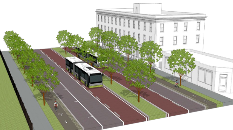
- Advanced engineering work, design work, and funding work to actualize the concept within the N Main St Vision Study, to prioritize public/active transit.
Data Requirements:
- All traffic, pedestrian, and cyclist studies concerning volume/speed on N Main St.
- Data is to be provided by RIDOT and the City of Providence.
- Two years of traffic stop data, including:
- Location
- Direction (northbound/southbound)
- Date/Time
- Offense
- Include registered speed if the offense was speeding.
- Data is to be provided by the Providence Police Dept. This data is necessary to understand all hazardous driver behavior under the current N Main St infrastructure.
- Location
- Anonymized geospatial cell phone data that indicates the motorist’s intended destination.
- This data could validate the need to divert traffic from N Main St to I-95
- E.g.: If people are getting off at Smithfield Ave to head downtown, then strategies for re-routing traffic to 95 could reduce volume.
- These datasets could provide speed data along specific segments of N Main St, potentially more effectively than ground-based data collection.
- This data could validate the need to divert traffic from N Main St to I-95
Past Studies/Reports:
- Providence Department of Planning and Development Staff Report: North Main Street intersection with Doyle Ave
- presented at the March 20, 2019, BPAC meeting
- North Main Street Corridor Revitalization Study – City of Providence
News Coverage
- Fast and furious: This Providence street pits pedestrians against cars, and pedestrians keep losing
- (Providence Journal, 1/24/2024)
- ‘I’m a little bit speechless’: Calls for action grow after another pedestrian hit on N. Main St.
- (Providence Journal, 1/6/2024)
- Data: 3K+ pedestrians and cyclists hit by cars in Providence over a 13-year span
- (WPRI, 11/15/2023)
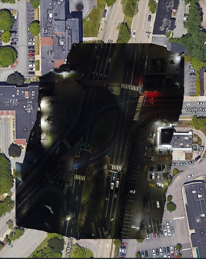
Intersections with poor lighting/pedestrian infrastructure:


